|
|
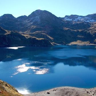
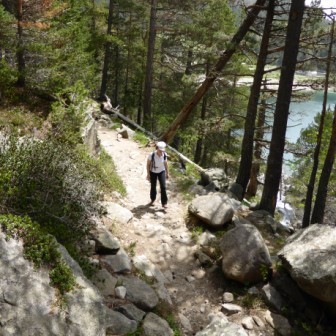
Five ideas for walks
|
|
About the Pyrenees
The Pyrenees are a range of mountains in southwest Europe that form a natural border between France and Spain. They separate the Iberian Peninsula from France, and extend for about 430km (267 mi) from the Bay of Biscay on the Atlantic Ocean to Cap de Creus on the Mediterranean Sea.
For the most part the main crest forms the Franco-Spanish frontier, with the principality of Andorra sandwiched between them. The principal exception to this rule is formed by the Val d'Aran, which belongs to Spain but lies on the north face of the range.
Geology
The Pyrenees are older than the Alps: their sediments were first deposited in coastal basins during the Paleozoic and Mesozoic eras - between 250 million and 65 million years ago. In the Lower Cretaceous period, the Gulf of Gascony (Bay of Biscay ) fanned out, pushing Spain against France and putting large layers of sediment in a vice grip. The intense pressure and uplifting of the Earth's crust first affected the eastern part and stretched progressively to the entire chain, culminating in the Eocene epoch.
The eastern part of the Pyrenees consists largely of granite and gneissose rocks, while in the western part the granite peaks are flanked by layers of limestone. The massive and unworn character of the chain comes from its abundance of granite, which is particularly resistant to erosion, as well as weak glacial development.
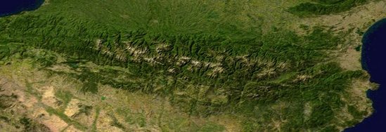
A View from Above
For the most part the main crest forms the Franco-Spanish frontier, with the principality of Andorra sandwiched between them. The principal exception to this rule is formed by the Val d'Aran, which belongs to Spain but lies on the north face of the range.
Geology
The Pyrenees are older than the Alps: their sediments were first deposited in coastal basins during the Paleozoic and Mesozoic eras - between 250 million and 65 million years ago. In the Lower Cretaceous period, the Gulf of Gascony (Bay of Biscay ) fanned out, pushing Spain against France and putting large layers of sediment in a vice grip. The intense pressure and uplifting of the Earth's crust first affected the eastern part and stretched progressively to the entire chain, culminating in the Eocene epoch.
The eastern part of the Pyrenees consists largely of granite and gneissose rocks, while in the western part the granite peaks are flanked by layers of limestone. The massive and unworn character of the chain comes from its abundance of granite, which is particularly resistant to erosion, as well as weak glacial development.
A View from Above
Highest summits:
Aneto (3,404 m)
Posets (3,375 m)
Monte Perdido (3,355 m)
Pic Maudit (3,350 m)
Pic du Cylindre (3,328 m)
Conspicuous features of Pyrenean scenery are:
- the absence of great lakes, such as fill the lateral valleys of the Alps
- the rarity and great elevation of passes
- the large number of the mountain torrents locally called gaves, which often form lofty - - waterfalls, surpassed in Europe only by those of Scandinavia
- the frequency with which the upper end of a valley assumes the form of a semicircle of precipitous cliffs, locally called a cirque.
The highest waterfall is that of Gavarnie (462 m / 1,515 ft), at the head of the Gave de Pau; the Cirque de Gavarnie, in the same valley, is perhaps the most famous example of the cirque formation. Low passes are lacking; between the two end of the range, where the principal roads and the railways run between France and Spain, there are only the Col de la Perche and the Col de Somport or Port de Canfranc, on the old Roman road from Saragossa to Oloron-Sainte-Marie.